SAND delivers cutting edge geophysical survey and consultancy, specialising in high-resolution seismic, sidescan sonar and magnetometry.
Consultancy Services
SAND Geophysics provides specialist consultancy services across offshore renewables, port and harbour developments, and unexploded ordnance (UXO) for pre-construction projects.
Get in touch with your project requirements and our team of specialist surveyors and geophysicists will provide tailored survey and consultancy services to deliver accurate and effective results for your specification.
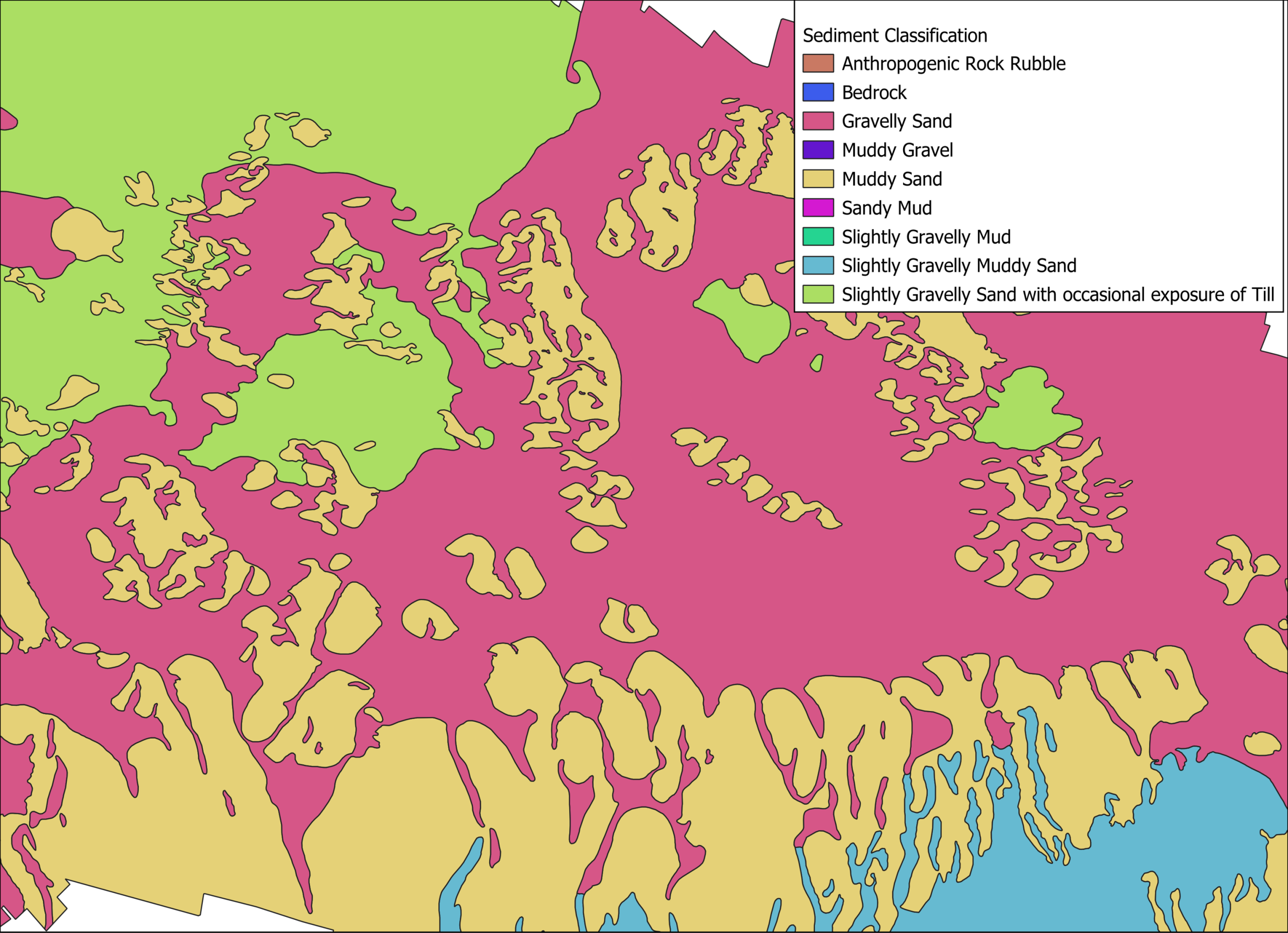
As part of our services, we can integrate large and diverse datasets from multiple sources to efficiently manage and compile information. This includes large scale sediment interpretations, correlating multi-sensor datasets and combining geotechnical data with geophysical datasets.
Data Review
SAND Geophysics provides comprehensive data processing and interpretation review across a wide range of sensors and surveys, including:
Assessing acquired datasets against survey specifications
Reviewing processed data to ensure it meets deliverable requirements
Reprocessing or reinterpreting data where necessary
Previous examples of data review include:
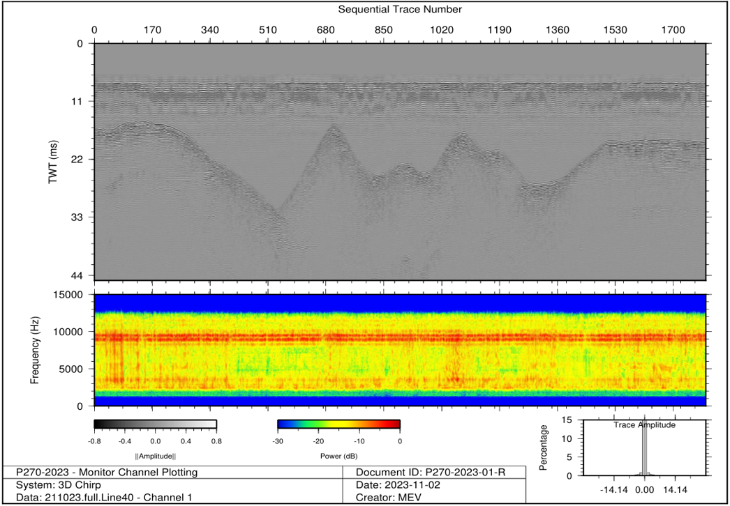
Seismic reprocessing to increase resolution at depth
Analysis of multi-beam echo sounder data to identify issues and provide solutions
Assessing ground model interpretation generated by AI software for reliability
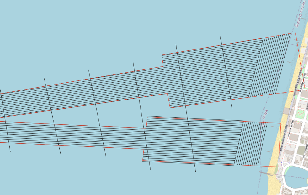
Survey Design & Specification
SAND Geophysics has experience working in large-scale offshore geophysical projects to smaller-scale nearshore projects. We have the technical expertise to assist with survey design and project specification, which includes:
Project specifications review
Technical knowledge & survey support
Sensor and equipment recommendations
Vessel specifications and recommendations
Tender Review
SAND Geophysics has extensive experience supporting both large-scale offshore geophysical projects and smaller nearshore campaigns. We have the technical expertise to assist with tender development and reviews, which includes:
Tender review
Technical knowledge & support
Planning comprehensive survey proposals which encompasses pricing, survey strategy, equipment and timeline
Technical Support & Advice
SAND Geophysics provides expert technical support and advice across a range survey operations and project planning, including:
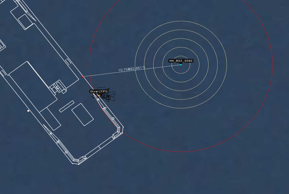
UXO Diver Positioning support
Remote survey setup and QC support for geophysical surveys
Equipment rental
Mobilisation engineer
Planning and Survey Consultation
GIS support and charting
Training
With over 15 years in the industry, we are equipped with the knowledge and expertise to provide training to meet your needs. We provide a variety of training packages, ranging from survey acquisition to data processing and deliverables.
EIVA – Introduction to NaviPac and Naviscan for general and bathymetric acquisition setup
BeamworX – Introduction to general acquisition setup